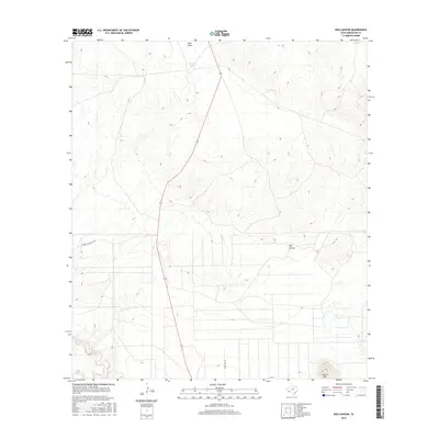
2016 Map of Dog Canyon
USGS Topo · Published 2016About this map
Dog Canyon serves as a central topographic landmark in this section of Brewster County, where the desert landscape is defined by drainage patterns and remote access roads. Evidence of regional activity is seen in the Cowboy Mining Co Rd and Lowery-Key Rd, which connect isolated water features like Dewees Tank and Hale Draw to the surrounding terrain. In the southern portion of the map, the seasonal path of Terlingua Cr winds near the base of Black Hill, illustrating the sparse but critical water resources of the Trans-Pecos. This 2016 survey captures the area's modern infrastructure within a geography characterized by deep canyons and prominent desert peaks.
Find a feature on this map
7 named features on this map. Tap any name to fly to it.
Don’t see what you’re looking for? This feature index may not catch every label — zoom into the map to look around manually.
Map Details
Editions of this 2016 Dog Canyon Map
This is the sole edition of this map. No revisions or reprints were ever made.
Other maps of this area

1917 · Agua Fria
USGS Topo · 1:62,500

1917 · Santiago Peak
USGS Topo · 1:62,500

1917 · Buck Hill
USGS Topo · 1:62,500

1918 · Bone Spring
USGS Topo · 1:125,000

1918 · Buck Hill
USGS Topo · 1:62,500

1918 · Santiago Peak
USGS Topo · 1:62,500

1918 · Nine Point Mesa
USGS Topo · 1:62,500

1925 · Buck Hill
USGS Topo · 1:62,500

1937 · Nine Point Mesa
USGS Topo · 1:62,500

1937 · Agua Fria
USGS Topo · 1:62,500