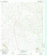
1983 Map of Dog Canyon
USGS Topo · Published 1984About this map
Dog Canyon and the surrounding high desert of Brewster County are defined by a landscape of intermittent drainage and stark elevation changes in this 1983 study. The northern reach of Terlingua Creek cuts through the southwest, while the dominant geological profile of Black Hill anchors the southern boundary. This map reveals a world of water scarcity, where man-made catchments like Dewees Tank and other unnamed tanks provided critical resources for ranching in an environment otherwise reliant on ephemeral flows through Hale Draw. The network of unimproved roads and light-duty paths shown here reflects a remote ranching economy dependent on these scattered water sources and the natural topography of the Trans-Pecos region during the late twentieth century.
Find a feature on this map
6 named features on this map. Tap any name to fly to it.
Don’t see what you’re looking for? This feature index may not catch every label — zoom into the map to look around manually.
Map Details
Editions of this 1983 Dog Canyon Map
This is the sole edition of this map. No revisions or reprints were ever made.
Other maps of this area

1917 · Agua Fria
USGS Topo · 1:62,500

1917 · Santiago Peak
USGS Topo · 1:62,500

1917 · Buck Hill
USGS Topo · 1:62,500

1918 · Bone Spring
USGS Topo · 1:125,000

1918 · Buck Hill
USGS Topo · 1:62,500

1918 · Santiago Peak
USGS Topo · 1:62,500

1918 · Nine Point Mesa
USGS Topo · 1:62,500

1925 · Buck Hill
USGS Topo · 1:62,500

1937 · Nine Point Mesa
USGS Topo · 1:62,500

1937 · Agua Fria
USGS Topo · 1:62,500