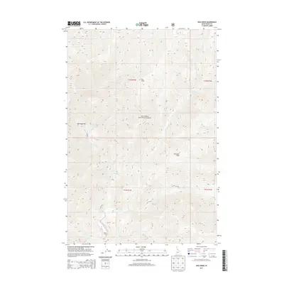
2013 Map of Dog Creek
USGS Topo · Published 2013About this map
Selway Lodge sits at the southern bend of the Selway River, representing a rare pocket of developed land within the expansive wilderness of the Nez Perce National Forest. The landscape is defined by its deep drainage networks, where a series of steep canyons are carved by waters like Pettibone Cr and Dog Cr. Notable geographic markers such as Dog Point and Pettibone Ridge command the high ground above the river valley, while Rattlesnake Bar marks a distinct point along the river's course. This area of Idaho County remains dominated by its natural topography, with human presence limited to isolated outposts and the rugged trails tracing the banks of Bear Creek and Crow Cr.
Find a feature on this map
21 named features on this map. Tap any name to fly to it.
Don’t see what you’re looking for? This feature index may not catch every label — zoom into the map to look around manually.
Map Details
Editions of this 2013 Dog Creek Map
This is the sole edition of this map. No revisions or reprints were ever made.
Other maps of this area

1911 · Lolo
USGS Topo · 1:250,000

1913 · Lolo
USGS Topo · 1:250,000

1956 · Elk City
USGS Topo · 1:250,000

1956 · Hamilton
USGS Topo · 1:250,000

1959 · Hamilton
USGS Topo · 1:250,000

1960 · Elk City
USGS Topo · 1:250,000

1960 · Hamilton
USGS Topo · 1:250,000

1964 · Hamilton
USGS Topo · 1:250,000

1966 · Twin Butte
USGS Topo · 1:24,000

1966 · Moose Ridge
USGS Topo · 1:24,000