
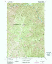
1966 Map of Moose Ridge
USGS Topo · Published 1968About this map
The Selway River cuts a deep corridor through this high-country expanse, managed within the Nez Perce National Forest and the Selway-Bitterroot Wilderness. The landscape is defined by its isolation and steep vertical relief, where travel is dictated by a network of Pack Trails rather than roads. Notable backcountry infrastructure includes the Moose Creek Landing Strip and a Lookout Tower positioned on Shearer Peak to monitor the dense forest. Many geographic features carry the names of early foresters or local lore, such as Tony Point, Grizzly Saddle, and Puzzle Point. The map provides a detailed view of the drainage systems that feed the Selway, including Moose Creek and Bitch Creek, which originates near Bitch Lake. This 1960s survey preserves the character of a primitive area where geographic landmarks like Moose Ridge and Wyllies Ridge were essential for navigation.
Find a feature on this map
32 named features on this map. Tap any name to fly to it.
Don’t see what you’re looking for? This feature index may not catch every label — zoom into the map to look around manually.
Map Details
Editions of this 1966 Moose Ridge Map
2 editions found
Other maps of this area

1911 · Lolo
USGS Topo · 1:250,000

1913 · Lolo
USGS Topo · 1:250,000

1956 · Elk City
USGS Topo · 1:250,000

1956 · Hamilton
USGS Topo · 1:250,000

1959 · Hamilton
USGS Topo · 1:250,000

1960 · Elk City
USGS Topo · 1:250,000

1960 · Hamilton
USGS Topo · 1:250,000

1964 · Hamilton
USGS Topo · 1:250,000

1966 · Dog Creek
USGS Topo · 1:24,000
1966 · Wylies Peak
USGS Topo · 1:24,000