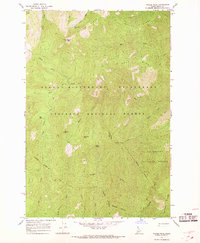
1966 Map of Wylies Peak
USGS Topo · Published 1968About this map
Wylies Peak dominates this high-altitude landscape within the Nezperce National Forest and Bitterroot National Forest in the mid-1960s. This region is defined by its protected status as part of the Selway-Bitterroot Wilderness, where human impact is limited to a network of established Pack Trails that navigate the ridges and drainages. The map reveals a complex hydrography feeding into the North Fork Creek, Elk Creek, and Running Creek systems, with high mountain water bodies like Lonesome Lake and Mud Lake serving as distinct landmarks.
Find a feature on this map
31 named features on this map. Tap any name to fly to it.
Don’t see what you’re looking for? This feature index may not catch every label — zoom into the map to look around manually.
Map Details
Editions of this 1966 Wylies Peak Map
3 editions found
Other maps of this area

1911 · Lolo
USGS Topo · 1:250,000

1913 · Lolo
USGS Topo · 1:250,000

1956 · Elk City
USGS Topo · 1:250,000

1956 · Hamilton
USGS Topo · 1:250,000

1959 · Hamilton
USGS Topo · 1:250,000

1960 · Elk City
USGS Topo · 1:250,000

1960 · Hamilton
USGS Topo · 1:250,000

1964 · Hamilton
USGS Topo · 1:250,000

1966 · Spot Mountain
USGS Topo · 1:24,000

1966 · Moose Ridge
USGS Topo · 1:24,000