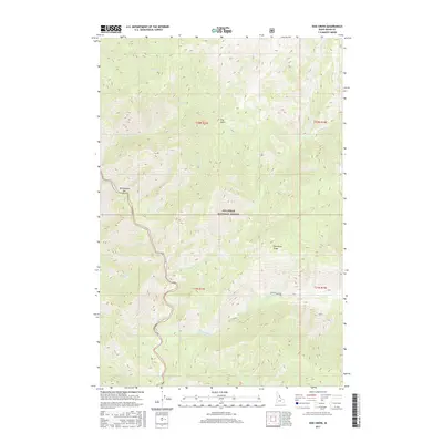
2017 Map of Dog Creek
USGS Topo · Published 2017About this map
The Selway River winds through the heart of the Nez Perce National Forest, defining the drainage patterns of this mountain terrain in Idaho County. This area is characterized by sharp elevations and significant watercourses, including the long reach of Pettibone Cr and the shorter, steep runs of Dog Cr and Hell Cr. Landmarks such as Dog Point and the prominent Pettibone Ridge offer natural orientation points for those navigating the wilderness. Along the riverbanks, features like Rattlesnake Bar hint at the seasonal shifts in the water's path and the depositional history of the river valley. The map also records numerous smaller tributaries such as Bear Creek, Cow Cr, and Ditch Cr, providing a detailed look at the complex watershed systems that have shaped this portion of northern Idaho.
Find a feature on this map
21 named features on this map. Tap any name to fly to it.
Don’t see what you’re looking for? This feature index may not catch every label — zoom into the map to look around manually.
Map Details
Editions of this 2017 Dog Creek Map
This is the sole edition of this map. No revisions or reprints were ever made.
Other maps of this area

1911 · Lolo
USGS Topo · 1:250,000

1913 · Lolo
USGS Topo · 1:250,000

1956 · Elk City
USGS Topo · 1:250,000

1956 · Hamilton
USGS Topo · 1:250,000

1959 · Hamilton
USGS Topo · 1:250,000

1960 · Elk City
USGS Topo · 1:250,000

1960 · Hamilton
USGS Topo · 1:250,000

1964 · Hamilton
USGS Topo · 1:250,000

1966 · Twin Butte
USGS Topo · 1:24,000

1966 · Moose Ridge
USGS Topo · 1:24,000