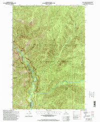
1995 Map of Dog Creek
USGS Topo · Published 1999About this map
The Selway Wild and Scenic River and the Middle Fork Clearwater River carve through this protected landscape within the Nez Perce National Forest. The geography is defined by steep elevation changes, rising from the riverbanks to high points like Dog Point and the prominent Pettibone Ridge. Human presence is sparse and localized, centered primarily on the Selway Lodge near the southern edge and the precarious Selway River Road tracing the western water gap. This 1995 revision, based on imagery from the early 1990s, documents the area as part of the Selway Bitterroot Wilderness, showing a landscape managed for its primitive character. Small landmarks like Rattlesnake Bar and drainage systems including Hell Creek, Glover Creek, and Crow Creek provide specific points of reference for navigating this deep interior river corridor.
Find a feature on this map
16 named features on this map. Tap any name to fly to it.
Don’t see what you’re looking for? This feature index may not catch every label — zoom into the map to look around manually.
Map Details
Editions of this 1995 Dog Creek Map
This is the sole edition of this map. No revisions or reprints were ever made.
Other maps of this area

1911 · Lolo
USGS Topo · 1:250,000

1913 · Lolo
USGS Topo · 1:250,000

1956 · Elk City
USGS Topo · 1:250,000

1956 · Hamilton
USGS Topo · 1:250,000

1959 · Hamilton
USGS Topo · 1:250,000

1960 · Elk City
USGS Topo · 1:250,000

1960 · Hamilton
USGS Topo · 1:250,000

1964 · Hamilton
USGS Topo · 1:250,000

1966 · Twin Butte
USGS Topo · 1:24,000

1966 · Moose Ridge
USGS Topo · 1:24,000