
1959 Map of Dog Mountain
USGS Topo · Published 1961About this map
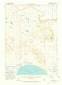
Malheur National Wildlife Refuge anchors the southern portion of this Harney County landscape, dominated by the expansive Harney Lake (Salt) and its surrounding Sand Dunes. The terrain is defined by dramatic volcanic and erosional features, most notably the prominent Wrights Point plateau and the eponymous Dog Mountain. The hydrology of the area in the late 1950s is remarkably complex, featuring a network of ephemeral basins and permanent waters such as Potters Swamp and Albert Lake. To the north, the Silvies River and Sage Hen Creek meander through the Sage Hen Valley, while numerous family-named landmarks like Frank Schmidt Lake and Batts Camp Lake suggest a history of localized grazing or homesteading. Transportation is sparse, relying on rugged routes like the Savage Grade Jeep Trail to navigate the canyons and hollows.
Find a feature on this map
44 named features on this map. Tap any name to fly to it.
Don’t see what you’re looking for? This feature index may not catch every label — zoom into the map to look around manually.
Map Details
Editions of this 1959 Dog Mountain Map
2 editions found
Other maps of this area

1955 · Burns
USGS Topo · 1:250,000

1958 · Burns
USGS Topo · 1:250,000

1959 · Burns
USGS Topo · 1:250,000

1959 · Harney
USGS Topo · 1:62,500

1959 · Lawen
USGS Topo · 1:62,500

1960 · Burns
USGS Topo · 1:62,500

1960 · Burns
USGS Topo · 1:24,000

1967 · Coyote Buttes
USGS Topo · 1:24,000

1975 · Burns
USGS Topo · 1:24,000

1978 · Malheur Lake
USGS Topo · 1:100,000