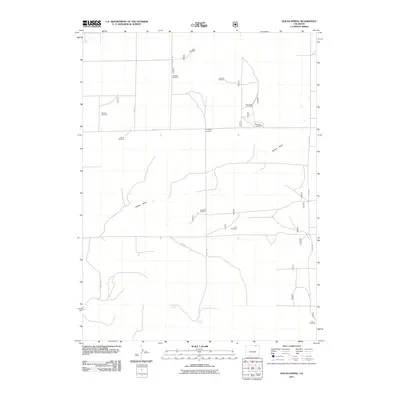
2011 Map of Dolan Spring
USGS Topo · Published 2011About this map
Sunnyside Cemetery stands as a focal point for local heritage in this northern Colorado landscape, located near the junction of Co RD 117 and Co RD 119. The terrain is characterized by the winding path of Sidney Draw and the essential presence of water sources such as Willow Spring and the namesake Dolan Spring. This area of Weld County reflects a specialized agricultural and industrial economy, where numerous named landmarks like Bain Windmill and Mule Shoe Windmill dot the plains, serving as vital infrastructure for ranching. The inclusion of the Mustang Oilfield indicates the region's dual role in energy production and traditional land use. The map provides a precise record of the county road grid, including Co RD 125 and Co RD 138, which structure the movement across this sparsely populated but functionally significant territory.
Find a feature on this map
22 named features on this map. Tap any name to fly to it.
Don’t see what you’re looking for? This feature index may not catch every label — zoom into the map to look around manually.
Map Details
Editions of this 2011 Dolan Spring Map
This is the sole edition of this map. No revisions or reprints were ever made.
Other maps of this area

1954 · Sterling
USGS Topo · 1:250,000

1954 · Scottsbluff
USGS Topo · 1:250,000

1954 · Cheyenne
USGS Topo · 1:250,000

1954 · Greeley
USGS Topo · 1:250,000

1957 · Greeley
USGS Topo · 1:250,000

1958 · Cheyenne
USGS Topo · 1:250,000

1958 · Greeley
USGS Topo · 1:250,000

1958 · Scottsbluff
USGS Topo · 1:250,000

1958 · Sterling
USGS Topo · 1:250,000

1961 · Greeley
USGS Topo · 1:250,000