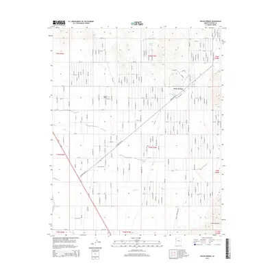
2014 Map of Dolan Springs
USGS Topo · Published 2014About this map
Dolan Springs sits at the eastern edge of the Mojave Desert, where the arid basin begins its transition toward the rising Cerbat Mountains. This 2014 survey illustrates a desert community defined by its sprawling network of residential roads, including N Pierce Ferry Rd, which serves as a primary artery through the subdivided landscape. The reliance on scarce water sources is evident through the marking of specific points like Sacaton Spring, Mud Spring, and the Number One Trough Tank. In the southern portion of the quadrangle, Putman Wash cuts across the terrain, indicating the drainage patterns that shape the local topography. The map detail reflects the mid-20th-century growth of this high-desert settlement, showing the extensive grid of street names that reached into the foothills before the landscape meets the more rugged mountain terrain to the east.
Find a feature on this map
186 named features on this map. Tap any name to fly to it.
Don’t see what you’re looking for? This feature index may not catch every label — zoom into the map to look around manually.
Map Details
Editions of this 2014 Dolan Springs Map
This is the sole edition of this map. No revisions or reprints were ever made.
Other maps of this area

1886 · Camp Mohave
USGS Topo · 1:250,000

1892 · Camp Mohave
USGS Topo · 1:250,000

1939 · Chloride
USGS Topo · 1:48,000

1942 · Camp Mohave
USGS Topo · 1:250,000

1944 · Chloride
USGS Topo · 1:62,500

1947 · Kingman
USGS Topo · 1:250,000

1948 · Kingman
USGS Topo · 1:250,000

1954 · Kingman
USGS Topo · 1:250,000

1955 · Kingman
USGS Topo · 1:250,000

1958 · Kingman
USGS Topo · 1:250,000