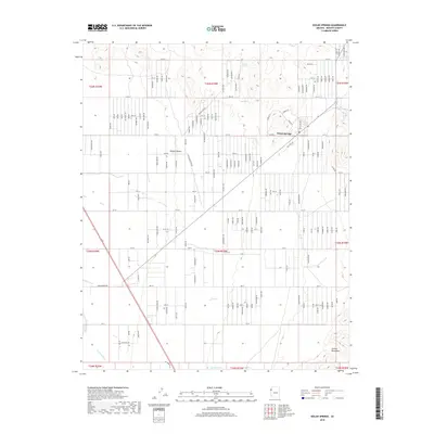
2018 Map of Dolan Springs
USGS Topo · Published 2018About this map
Dolan Springs serves as the focal point of this arid landscape, where the residential grid meets the wide alluvial fans of the Mojave Desert. The map reveals a highly structured network of numbered streets and avenues, such as 11th St and W Taylor Ave, that contrast with the natural drainage patterns of Detrital Wash and Putman Wash. To the east, the terrain rises sharply into the Cerbat Mountains, a geographical boundary that defines the community's edge. Water sources, vital for settlement in this desert environment, are represented by Sacaton Spring and Mud Spring in the northern reaches of the quadrangle. The layout of the town reflects a modern era of expansion, with long, straight roads like Don Nell Dr and Imp Rd connecting the scattered properties of this Mohave County community.
Find a feature on this map
37 named features on this map. Tap any name to fly to it.
Don’t see what you’re looking for? This feature index may not catch every label — zoom into the map to look around manually.
Map Details
Editions of this 2018 Dolan Springs Map
This is the sole edition of this map. No revisions or reprints were ever made.
Other maps of this area

1886 · Camp Mohave
USGS Topo · 1:250,000

1892 · Camp Mohave
USGS Topo · 1:250,000

1939 · Chloride
USGS Topo · 1:48,000

1942 · Camp Mohave
USGS Topo · 1:250,000

1944 · Chloride
USGS Topo · 1:62,500

1947 · Kingman
USGS Topo · 1:250,000

1948 · Kingman
USGS Topo · 1:250,000

1954 · Kingman
USGS Topo · 1:250,000

1955 · Kingman
USGS Topo · 1:250,000

1958 · Kingman
USGS Topo · 1:250,000