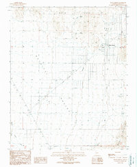
1989 Map of Dolan Springs
USGS Topo · Published 1990About this map
Dolan Springs sits at the eastern edge of the Detrital Valley, positioned beneath the southern reaches of the White Hills. This late-century survey reveals a desert community supported by essential infrastructure, including a Pearce Ferry Road and a local Landing Strip. The map illustrates the town's social and recreational layout with the Rodeo Ground and an Athletic Field near the center of the settlement. Water sources are critical in this arid landscape, evidenced by the presence of Sacaton Spring, Mud Spring, and the Larson Dam. The western portion of the quadrangle is dominated by the broad drainage patterns of Detrital Wash and Putman Wash, which flow toward the northwest. Evidence of local industry is sparse, limited to a Gravel Pit located near the northern town limits.
Find a feature on this map
21 named features on this map. Tap any name to fly to it.
Don’t see what you’re looking for? This feature index may not catch every label — zoom into the map to look around manually.
Map Details
Editions of this 1989 Dolan Springs Map
This is the sole edition of this map. No revisions or reprints were ever made.
Other maps of this area

1886 · Camp Mohave
USGS Topo · 1:250,000

1892 · Camp Mohave
USGS Topo · 1:250,000

1939 · Chloride
USGS Topo · 1:48,000

1942 · Camp Mohave
USGS Topo · 1:250,000

1944 · Chloride
USGS Topo · 1:62,500

1947 · Kingman
USGS Topo · 1:250,000

1948 · Kingman
USGS Topo · 1:250,000

1954 · Kingman
USGS Topo · 1:250,000

1955 · Kingman
USGS Topo · 1:250,000

1958 · Kingman
USGS Topo · 1:250,000