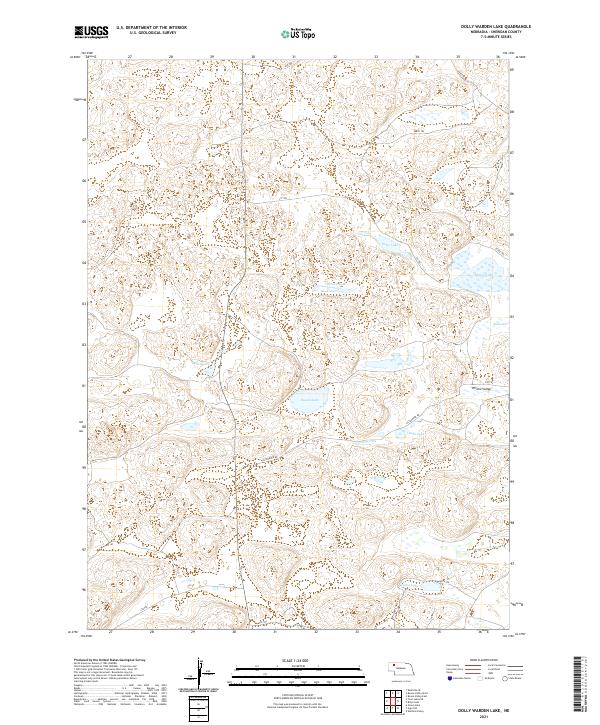
2021 Map of Dolly Warden Lake
USGS Topo · Published 2021About this map
Sandoz Lake and the nearby Sandoz Grave Rd anchor the southern reaches of this Sheridan County landscape, where the high plains are punctuated by a series of significant alkaline and freshwater basins. The area is defined by its specific water-retention patterns, with Miller Lake and Round Lake serving as central landmarks in a terrain characterized by Willow Valley and various sandhills depressions.
Find a feature on this map
21 named features on this map. Tap any name to fly to it.
Don’t see what you’re looking for? This feature index may not catch every label — zoom into the map to look around manually.
Map Details
Editions of this 2021 Dolly Warden Lake Map
This is the sole edition of this map. No revisions or reprints were ever made.
Other maps of this area

1948 · Twin Lakes
USGS Topo · 1:62,500

1948 · Spade Ranch
USGS Topo · 1:62,500

1950 · Twin Lakes
USGS Topo · 1:62,500

1950 · Spade Ranch
USGS Topo · 1:62,500

1955 · Alliance
USGS Topo · 1:250,000

1957 · Alliance
USGS Topo · 1:250,000

1958 · Alliance
USGS Topo · 1:250,000

1969 · Rushville 4 SW
USGS Topo · 1:24,000

1969 · Rushville SE
USGS Topo · 1:24,000
1969 · Rushville 4 SE
USGS Topo · 1:24,000