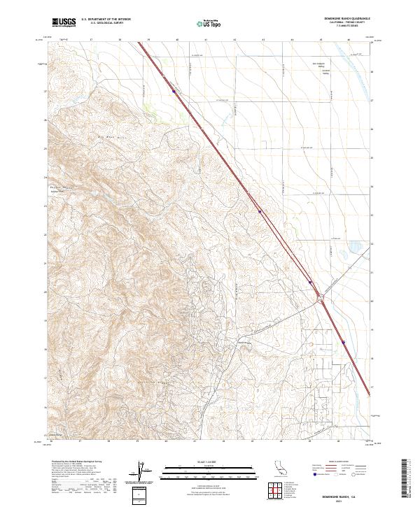
2021 Map of Domengine Ranch
USGS Topo · Published 2021About this map
Anticline Ridge and the foothills of the Diablo Range dominate the western portion of this Fresno County landscape, where the terrain drops sharply toward the San Joaquin Valley. The map documents a sophisticated water management system vital to the Central Valley agricultural economy, headlined by the massive Governor Edmund G Brown California Aqueduct and the Coalinga Canal. These engineering feats run parallel to the historic Coalinga-Mendota Rd, which cuts diagonally across the basin.
Find a feature on this map
32 named features on this map. Tap any name to fly to it.
Don’t see what you’re looking for? This feature index may not catch every label — zoom into the map to look around manually.
Map Details
Editions of this 2021 Domengine Ranch Map
This is the sole edition of this map. No revisions or reprints were ever made.
Other maps of this area

1912 · Coalinga
USGS Topo · 1:125,000

1928 · Delta Farms No 3
USGS Topo · 1:31,680

1931 · Towne Oil Station
USGS Topo · 1:31,680

1931 · Mouth of Cantua Creek
USGS Topo · 1:31,680

1932 · Delta Farms
USGS Topo · 1:31,680

1933 · Guijarral Hills
USGS Topo · 1:31,680
1936 · Guijarral Hills
USGS Topo · 1:31,680
1937 · Guijarral Hills
USGS Topo · 1:31,680
1942 · Polvadero Gap
USGS Topo · 1:62,500

1943 · Joaquin Rocks
USGS Topo · 1:62,500