
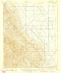
1943 Map of Joaquin Rocks
USGS Topo · Published 1943About this map
The rugged western edge of the San Joaquin Valley meets the rising foothills of the Coast Ranges in this early 1940s survey. The landscape is defined by the massive sandstone formation of the Joaquin Rocks and the prominent Monocline Ridge, where dramatic topographical changes separate the flat valley floor from the deep incisions of Horsethief Canyon and Urruffia Canyon. This area shows a transition from agricultural land use on the plains to isolated ranching outposts in the higher elevations.
Find a feature on this map
28 named features on this map. Tap any name to fly to it.
Don’t see what you’re looking for? This feature index may not catch every label — zoom into the map to look around manually.
Map Details
Editions of this 1943 Joaquin Rocks Map
2 editions found
Other maps of this area

1912 · Coalinga
USGS Topo · 1:125,000

1913 · Panoche
USGS Topo · 1:125,000

1915 · Priest Valley
USGS Topo · 1:125,000

1923 · Levis
USGS Topo · 1:31,680

1923 · Englebrecht Ranch
USGS Topo · 1:31,680

1923 · Monocline Ridge
USGS Topo · 1:31,680

1925 · San Joaquin
USGS Topo · 1:31,680

1928 · Delta Farms No 3
USGS Topo · 1:31,680

1931 · Towne Oil Station
USGS Topo · 1:31,680

1931 · Mouth of Cantua Creek
USGS Topo · 1:31,680