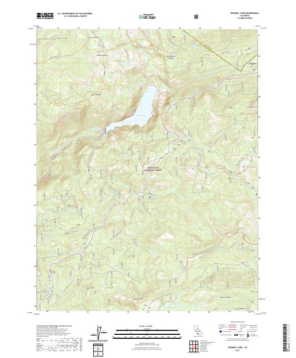
2021 Map of Donnell Lake
USGS Topo · Published 2021About this map
Stanislaus National Forest encompasses this high-elevation landscape, where the Middle Fork Stanislaus River feeds into the central Donnell Lake. This modern survey records a terrain defined by granite features and seasonal water, including landmarks like Dome Rock and Bull Run Rock. Evidence of early access and mountain burial exists at the Mill Creek Cem near Mill Cr, a significant site for local history researchers tracing the human footprint in these meadows.
Find a feature on this map
59 named features on this map. Tap any name to fly to it.
Don’t see what you’re looking for? This feature index may not catch every label — zoom into the map to look around manually.
Map Details
Editions of this 2021 Donnell Lake Map
This is the sole edition of this map. No revisions or reprints were ever made.
Other maps of this area

1891 · Big Trees
USGS Topo · 1:125,000

1894 · Big Trees
USGS Topo · 1:125,000

1896 · Dardanelles
USGS Topo · 1:125,000

1897 · Big Trees
USGS Topo · 1:125,000

1898 · Dardanelles
USGS Topo · 1:125,000

1901 · Big Trees
USGS Topo · 1:125,000

1947 · Sacramento
USGS Topo · 1:250,000

1948 · Walker Lake
USGS Topo · 1:250,000

1948 · Sacramento
USGS Topo · 1:250,000

1956 · Sacramento
USGS Topo · 1:250,000