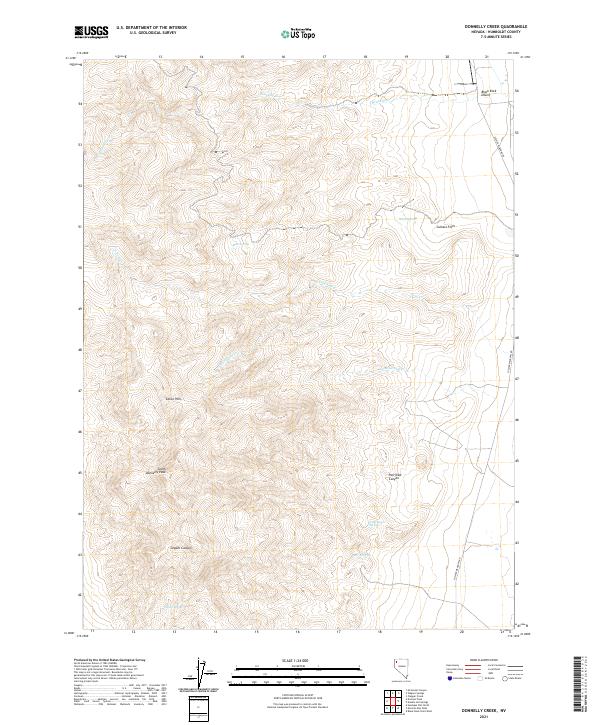
2021 Map of Donnelly Creek
USGS Topo · Published 2021About this map
South Donnelly Peak anchors this high-elevation terrain in northwestern Nevada, where the drainage systems of Donnelly Cr and the various forks of Cow Cr define the local topography. This arid landscape is shaped by the transition from the Calico Hills into the edge of the Black Rock Desert, a region known for its stark geothermal and geologic history. The map detail highlights the critical importance of water sources in this environment, marking numerous points like Buck Springs, Sheep Spring, and Government Spring.
Find a feature on this map
21 named features on this map. Tap any name to fly to it.
Don’t see what you’re looking for? This feature index may not catch every label — zoom into the map to look around manually.
Map Details
Editions of this 2021 Donnelly Creek Map
This is the sole edition of this map. No revisions or reprints were ever made.
Other maps of this area

1886 · Granite Range
USGS Topo · 1:250,000

1889 · Long Valley
USGS Topo · 1:250,000

1894 · Granite Range
USGS Topo · 1:250,000

1954 · Vya
USGS Topo · 1:250,000

1955 · Lovelock
USGS Topo · 1:250,000

1958 · Vya
USGS Topo · 1:250,000

1959 · Lovelock
USGS Topo · 1:250,000

1962 · Vya
USGS Topo · 1:250,000
1979 · Double Hot Springs
USGS Topo · 1:24,000
1980 · Clapper Creek
USGS Topo · 1:24,000