
1959 Map of Lovelock
USGS Topo · Published 1959About this map
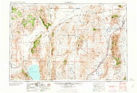
Lovelock serves as the focal point for this mid-century look at the high desert basin and range country of northwestern Nevada. The map captures a landscape defined by expansive playas and alkaline flats, notably the Black Rock Desert and the Granite Creek Desert, which were then shared by ranching interests, railroad siding stops, and a massive U S Naval Gunnery Range. Along the eastern corridor, the Southern Pacific railroad follows the path of the Humboldt River, connecting small settlements like Imlay and Toulon. To the west, the Pyramid Lake Indian Reservation encompasses the deep waters of Pyramid Lake, while the adjacent Winnemucca Lake is shown within the Winnemucca National Wildlife Refuge. The map provides a clear record of the region's transport network before major interstate development, including the Western Pacific line passing through the remote settlement of Gerlach.
Find a feature on this map
31 named features on this map. Tap any name to fly to it.
Don’t see what you’re looking for? This feature index may not catch every label — zoom into the map to look around manually.
Map Details
Editions of this 1959 Lovelock Map
2 editions found
Other maps of this area

1882 · Paradise
USGS Topo · 1:250,000

1886 · Alturas
USGS Topo · 1:250,000

1886 · Honey Lake
USGS Topo · 1:250,000

1886 · Disaster
USGS Topo · 1:250,000

1886 · Granite Range
USGS Topo · 1:250,000

1889 · Long Valley
USGS Topo · 1:250,000

1890 · Wadsworth
USGS Topo · 1:125,000

1890 · Sierraville
USGS Topo · 1:125,000

1891 · Honey Lake
USGS Topo · 1:250,000

1891 · Reno
USGS Topo · 1:125,000