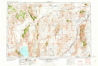
1959 Map of Lovelock
USGS Topo · Published 1959About this map
Pyramid Lake and the expanse of the Black Rock Desert dominate this 1950s study of northwestern Nevada. The landscape is defined by the high-desert basins and ranges that stretch between the Nevada California border and the Humboldt River. Significant industrial and military footprints are evident, from the sprawling U S Naval Gunnery Range to active mining operations like the Pershing Quicksilver Mines and the Nevada Massachusetts Tungsten Mine and Mill. The corridor along the Southern Pacific railroad reveals the importance of rail transit to the regional economy, connecting settlements such as Lovelock and Imlay. Remote outposts and family-named landmarks like Buffalo Meadows Ranch and Dolly Varden Ranch provide a window into the rural life of Pershing and Washoe Counties during this era. High peaks, including Star Peak and Majuba Mountain, tower over the dry lake beds and sagebrush valleys.
Find a feature on this map
101 named features on this map. Tap any name to fly to it.
Don’t see what you’re looking for? This feature index may not catch every label — zoom into the map to look around manually.
Map Details
Editions of this 1959 Lovelock Map
2 editions found

Other maps of this area

1882 · Paradise
USGS Topo · 1:250,000

1886 · Alturas
USGS Topo · 1:250,000

1886 · Honey Lake
USGS Topo · 1:250,000

1886 · Disaster
USGS Topo · 1:250,000

1886 · Granite Range
USGS Topo · 1:250,000

1889 · Long Valley
USGS Topo · 1:250,000

1890 · Wadsworth
USGS Topo · 1:125,000

1890 · Sierraville
USGS Topo · 1:125,000

1891 · Honey Lake
USGS Topo · 1:250,000

1891 · Reno
USGS Topo · 1:125,000