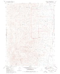
1980 Map of Donnelly Creek
USGS Topo · Published 1980About this map
Jackson Ranch and the isolated Morley Place stand as the primary human markers in this high-desert landscape during the late 1970s. The terrain is dominated by the steep rises of the Calico Hills, culminating at South Donnelly Peak. Water, the most precious resource in the region, is meticulously recorded through a series of named sources including Cottonwood Spring, Government Spring, and Burro Spring, which likely supported local ranching and transit.
Find a feature on this map
22 named features on this map. Tap any name to fly to it.
Don’t see what you’re looking for? This feature index may not catch every label — zoom into the map to look around manually.
Map Details
Editions of this 1980 Donnelly Creek Map
This is the sole edition of this map. No revisions or reprints were ever made.
Other maps of this area

1886 · Granite Range
USGS Topo · 1:250,000

1889 · Long Valley
USGS Topo · 1:250,000

1894 · Granite Range
USGS Topo · 1:250,000

1954 · Vya
USGS Topo · 1:250,000

1955 · Lovelock
USGS Topo · 1:250,000

1958 · Vya
USGS Topo · 1:250,000

1959 · Lovelock
USGS Topo · 1:250,000

1962 · Vya
USGS Topo · 1:250,000
1979 · Double Hot Springs
USGS Topo · 1:24,000
1980 · Clapper Creek
USGS Topo · 1:24,000