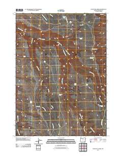
2011 Map of Doolittle Creek
USGS Topo · Published 2011About this map
Doolittle Camp serves as a lone named waypoint in this high-desert landscape of Malheur County, where the survival of livestock once depended on a network of isolated water sources. The terrain is defined by the drainage systems of Whitehorse Creek and Doolittle Creek, which cut through an arid expanse punctuated by the curiously named Death Trap and the prominent Twin Peaks.
Find a feature on this map
27 named features on this map. Tap any name to fly to it.
Don’t see what you’re looking for? This feature index may not catch every label — zoom into the map to look around manually.
Map Details
Editions of this 2011 Doolittle Creek Map
This is the sole edition of this map. No revisions or reprints were ever made.
Other maps of this area

1955 · Jordan Valley
USGS Topo · 1:250,000

1955 · Adel
USGS Topo · 1:250,000

1957 · Adel
USGS Topo · 1:250,000

1957 · Jordan Valley
USGS Topo · 1:250,000

1958 · Adel
USGS Topo · 1:250,000

1958 · Jordan Valley
USGS Topo · 1:250,000

1962 · Adel
USGS Topo · 1:250,000
1981 · Little Whitehorse Creek
USGS Topo · 1:24,000
1981 · Dry Creek Bench
USGS Topo · 1:24,000
1981 · Doolittle Creek
USGS Topo · 1:24,000