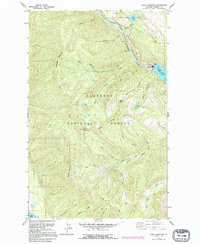
1991 Map of Doris Mountain
USGS Topo · Published 1995About this map
Doris Mountain and the surrounding heights of the Flathead National Forest dominate this 1990s-era topographic survey. The landscape is defined by the significant hydraulic infrastructure of the South Fork Flathead River, where the northern reach of the Hungry Horse Reservoir meets a dedicated Powerhouse and Substation. The map details a complex network of forest management routes, including the Doris Creek Road and specialized paths like the Alpine Trail and Aurora Trail.
Find a feature on this map
43 named features on this map. Tap any name to fly to it.
Don’t see what you’re looking for? This feature index may not catch every label — zoom into the map to look around manually.
Map Details
Editions of this 1991 Doris Mountain Map
This is the sole edition of this map. No revisions or reprints were ever made.
Other maps of this area

1914 · Nyack
USGS Topo · 1:125,000

1943 · Kalispell
USGS Topo · 1:125,000

1957 · Kalispell
USGS Topo · 1:250,000

1960 · Kalispell
USGS Topo · 1:250,000

1960 · Cut Bank
USGS Topo · 1:250,000

1961 · Kalispell
USGS Topo · 1:250,000

1962 · Columbia Falls South
USGS Topo · 1:24,000

1962 · Doris Mountain
USGS Topo · 1:24,000

1962 · Hungry Horse
USGS Topo · 1:24,000

1962 · Creston
USGS Topo · 1:24,000