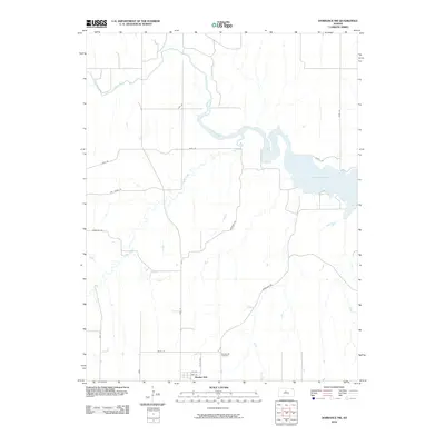
2010 Map of Dorrance NW
USGS Topo · Published 2010About this map
Bunker Hill sits at the southern edge of this West Central Kansas landscape, serving as a focal point for the surrounding rural area. The terrain is defined by the significant hydrology of the Saline River, which meanders across the northern half of the quadrangle before broadening into the western reaches of the Wilson Reservoir. This water system creates a distinct geographic break from the grid-like road network that organizes the upland prairies. Local history is anchored by the Bunker Hill Cemetery, located just north of the town center. The map details a transition from traditional agricultural land use toward the recreational and infrastructural developments associated with the reservoir, evidenced by named routes like Resevoir Rd and Shoreline Dr. Tributaries like Cedar Creek cut through the sections, illustrating the natural drainage patterns that have shaped the placement of local thoroughfares such as Balta Rd and Anspaugh Rd.
Find a feature on this map
21 named features on this map. Tap any name to fly to it.
Don’t see what you’re looking for? This feature index may not catch every label — zoom into the map to look around manually.
Map Details
Editions of this 2010 Dorrance NW Map
This is the sole edition of this map. No revisions or reprints were ever made.
Other maps of this area

1896 · Osborne
USGS Topo · 1:125,000

1896 · Russell
USGS Topo · 1:125,000

1955 · Great Bend
USGS Topo · 1:250,000

1955 · Beloit
USGS Topo · 1:250,000

1956 · Dorrance
USGS Topo · 1:24,000

1956 · Dorrance SW
USGS Topo · 1:24,000

1957 · Great Bend
USGS Topo · 1:250,000

1958 · Great Bend
USGS Topo · 1:250,000

1959 · Beloit
USGS Topo · 1:250,000

1961 · Homer
USGS Topo · 1:24,000