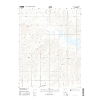
2015 Map of Dorrance NW
USGS Topo · Published 2015About this map
Bunker Hill sits at the southern edge of this Russell County landscape, a small prairie settlement defined by its grid of local streets like Balta Rd and 2nd St. North of the town center, the Bunker Hill Cem serves as a vital touchstone for genealogical research in the area. The topography shifts dramatically as the terrain descends toward the vast Wilson Lake and the meandering path of the Saline River. This hydrologic network is further fed by Cedar Creek and Elm Cr, creating a complex series of drainage patterns and draws across the central and northern portions of the quadrangle. A network of rural section-line roads, including Decker Rd and Mellard Rd, provides access to the higher ground overlooking the reservoir, while Resevoir Rd and W Shoreline Rd trace the jagged western margins of the water.
Find a feature on this map
37 named features on this map. Tap any name to fly to it.
Don’t see what you’re looking for? This feature index may not catch every label — zoom into the map to look around manually.
Map Details
Editions of this 2015 Dorrance NW Map
This is the sole edition of this map. No revisions or reprints were ever made.
Other maps of this area

1896 · Osborne
USGS Topo · 1:125,000

1896 · Russell
USGS Topo · 1:125,000

1955 · Great Bend
USGS Topo · 1:250,000

1955 · Beloit
USGS Topo · 1:250,000

1956 · Dorrance
USGS Topo · 1:24,000

1956 · Dorrance SW
USGS Topo · 1:24,000

1957 · Great Bend
USGS Topo · 1:250,000

1958 · Great Bend
USGS Topo · 1:250,000

1959 · Beloit
USGS Topo · 1:250,000

1961 · Homer
USGS Topo · 1:24,000