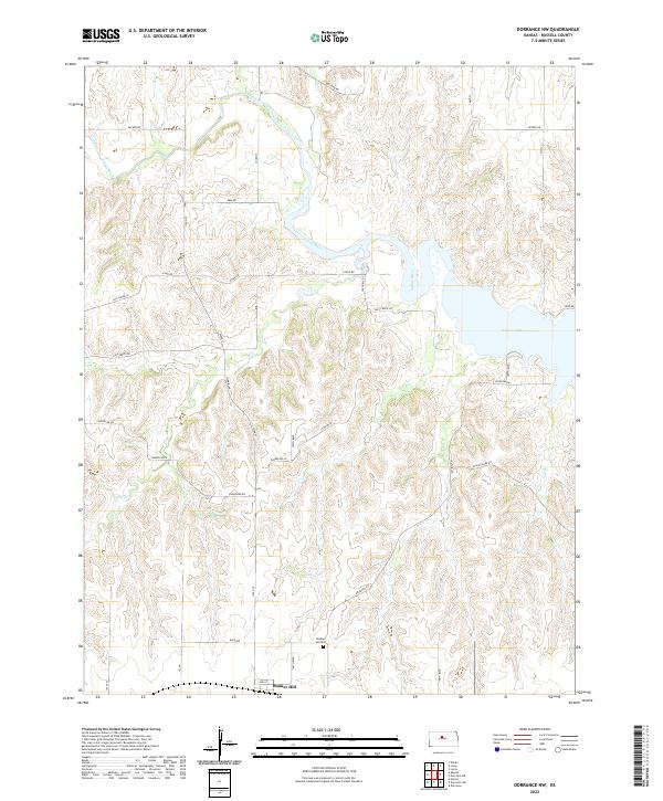
2022 Map of Dorrance NW
USGS Topo · Published 2022About this map
Bunker Hill sits at the southern edge of this West-Central Kansas landscape, where the high plains break into the drainage systems of the Saline River. The terrain is defined by the carved valleys of Cedar Cr and Elm Cr, which flow northward toward the significant expanse of Wilson Lake. This reservoir dominates the eastern portion of the map, its irregular shoreline tracing the contours of the submerged river valley.
Find a feature on this map
26 named features on this map. Tap any name to fly to it.
Don’t see what you’re looking for? This feature index may not catch every label — zoom into the map to look around manually.
Map Details
Editions of this 2022 Dorrance NW Map
This is the sole edition of this map. No revisions or reprints were ever made.
Other maps of this area

1896 · Osborne
USGS Topo · 1:125,000

1896 · Russell
USGS Topo · 1:125,000

1955 · Great Bend
USGS Topo · 1:250,000

1955 · Beloit
USGS Topo · 1:250,000

1956 · Dorrance
USGS Topo · 1:24,000

1956 · Dorrance SW
USGS Topo · 1:24,000

1957 · Great Bend
USGS Topo · 1:250,000

1958 · Great Bend
USGS Topo · 1:250,000

1959 · Beloit
USGS Topo · 1:250,000

1961 · Homer
USGS Topo · 1:24,000