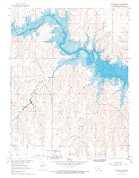
1967 Map of Dorrance NW
USGS Topo · Published 1968About this map
The Wilson Reservoir dominates the northern half of this landscape, where the waters of the Saline River are impounded within a complex of winding inlets and drainage basins. Surveyed in the late 1960s, this area of Russell County reflects a transition from river-valley agriculture to large-scale water management. To the south, the terrain rises toward the community of Bunker Hill, a rail-oriented settlement defined by the Union Pacific line.
Find a feature on this map
14 named features on this map. Tap any name to fly to it.
Don’t see what you’re looking for? This feature index may not catch every label — zoom into the map to look around manually.
Map Details
Editions of this 1967 Dorrance NW Map
This is the sole edition of this map. No revisions or reprints were ever made.
Other maps of this area

1896 · Osborne
USGS Topo · 1:125,000

1896 · Russell
USGS Topo · 1:125,000

1955 · Great Bend
USGS Topo · 1:250,000

1955 · Beloit
USGS Topo · 1:250,000

1956 · Dorrance
USGS Topo · 1:24,000

1956 · Dorrance SW
USGS Topo · 1:24,000

1957 · Great Bend
USGS Topo · 1:250,000

1958 · Great Bend
USGS Topo · 1:250,000

1959 · Beloit
USGS Topo · 1:250,000

1961 · Homer
USGS Topo · 1:24,000