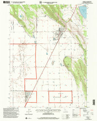
2001 Map of Dorris
USGS Topo · Published 2004About this map
The high desert agriculture and timber town of Dorris anchors this survey of northernmost Siskiyou County, appearing at the turn of the 21st century as a hub for both the Mt Shasta Line and regional education at Butte Valley High Sch. The map reveals a landscape defined by water management and public lands, featuring the extensive Butte Valley National Grassland and portions of the Klamath National Forest. Geologists and local historians can trace the irrigation network through numerous wells and the Ditch system that supports the floor of Butte Valley. Significant landmarks include the Picard Cem and the Butte Valley Airport, while natural features like Indian Tom Lake and Mud Lake offer a contrast to the geometric agricultural plots. This edition, revised by the Forest Service, documents the intersection of rural transit and mountainous terrain near the Oregon border.
Find a feature on this map
30 named features on this map. Tap any name to fly to it.
Don’t see what you’re looking for? This feature index may not catch every label — zoom into the map to look around manually.
Map Details
Editions of this 2001 Dorris Map
This is the sole edition of this map. No revisions or reprints were ever made.
Other maps of this area

1886 · Modoc Lava Bed
USGS Topo · 1:250,000

1886 · Shasta
USGS Topo · 1:250,000

1889 · Klamath
USGS Topo · 1:250,000

1891 · Ashland
USGS Topo · 1:250,000

1892 · Modoc Lava-Bed
USGS Topo · 1:250,000

1893 · Ashland
USGS Topo · 1:250,000

1894 · Klamath
USGS Topo · 1:250,000

1894 · Shasta
USGS Topo · 1:250,000

1897 · Ashland
USGS Topo · 1:250,000

1934 · Macdoel
USGS Topo · 1:96,000