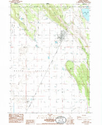
1985 Map of Dorris
USGS Topo · Published 1985About this map
Dorris sits at the northern edge of Butte Valley on this mid-1980s survey, positioned as a vital border crossing where the Southern Pacific railroad meets the Oregon California state line. The landscape is defined by the transition from the flat agricultural basin of the valley to the surrounding volcanic heights of Dorris Hill and Otey Ridge. To the west, the older settlement of Picard remains marked by the Picard Cem, a key landmark for local genealogists.
Find a feature on this map
28 named features on this map. Tap any name to fly to it.
Don’t see what you’re looking for? This feature index may not catch every label — zoom into the map to look around manually.
Map Details
Editions of this 1985 Dorris Map
This is the sole edition of this map. No revisions or reprints were ever made.
Other maps of this area

1886 · Modoc Lava Bed
USGS Topo · 1:250,000

1886 · Shasta
USGS Topo · 1:250,000

1889 · Klamath
USGS Topo · 1:250,000

1891 · Ashland
USGS Topo · 1:250,000

1892 · Modoc Lava-Bed
USGS Topo · 1:250,000

1893 · Ashland
USGS Topo · 1:250,000

1894 · Klamath
USGS Topo · 1:250,000

1894 · Shasta
USGS Topo · 1:250,000

1897 · Ashland
USGS Topo · 1:250,000

1934 · Macdoel
USGS Topo · 1:96,000