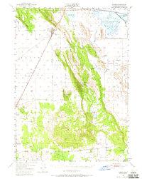
1950 Map of Dorris
USGS Topo · Published 1965About this map
Dorris serves as a primary hub for commerce and transport in this high-altitude basin at the California-Oregon border. The presence of the Southern Pacific railroad and a Plant Quarantine Sta at the state line highlights the town's role in interstate agricultural movement and logistics during the mid-century. To the east, the landscape transitions from the agricultural Oklahoma Flat into the conserved wetlands of the National Wildlife Refuge, protecting Lower Klamath Lake and Sheepy Lake. High desert peaks like Mahogany Mountain and Sheep Mtn break the valley floor, while smaller settlements like Macdoel and family-run operations such as Porterfield Ranch and Parsons Ranch suggest a scattered but established ranching community. Genealogists will find particular value in the locations of the Picard Cem and the Lakeview Cem, alongside rural education sites like Oklahoma Sch and Red Rock Sch.
Find a feature on this map
39 named features on this map. Tap any name to fly to it.
Don’t see what you’re looking for? This feature index may not catch every label — zoom into the map to look around manually.
Map Details
Editions of this 1950 Dorris Map
4 editions found

Other maps of this area

1886 · Modoc Lava Bed
USGS Topo · 1:250,000

1886 · Shasta
USGS Topo · 1:250,000

1889 · Klamath
USGS Topo · 1:250,000

1891 · Ashland
USGS Topo · 1:250,000

1892 · Modoc Lava-Bed
USGS Topo · 1:250,000

1893 · Ashland
USGS Topo · 1:250,000

1894 · Klamath
USGS Topo · 1:250,000

1894 · Shasta
USGS Topo · 1:250,000

1897 · Ashland
USGS Topo · 1:250,000

1934 · Macdoel
USGS Topo · 1:96,000