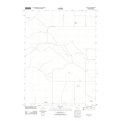
2012 Map of Doty Hill
USGS Topo · Published 2012About this map
Rockeagle and Harmony Heights anchor this corner of Goshen County, showing the sparse but organized settlement patterns of the Wyoming plains in the early 21st century. The landscape is defined by its subtle watercourses, most notably Cherry Cr and Deer Cr, which carve through the high ground. The terrain is dominated by the prominent rise of Doty Hill and the distinct formation of Horseshoe Butte to the southeast. Much of the region is characterized by the broad, low-lying expanse of the Goshen Hole, a significant geological depression that influenced the placement of local roads like Teeters Rd and Booth Rd. The map reveals a grid of county roads, including Harmony Heights Rd and Rim Rock Rd, which follow the section lines and natural contours of the plateau to connect these remote ranching communities.
Find a feature on this map
18 named features on this map. Tap any name to fly to it.
Don’t see what you’re looking for? This feature index may not catch every label — zoom into the map to look around manually.
Map Details
Editions of this 2012 Doty Hill Map
This is the sole edition of this map. No revisions or reprints were ever made.
Other maps of this area

1896 · Patrick
USGS Topo · 1:125,000

1896 · Hartville
USGS Topo · 1:125,000

1899 · Goshen Hole
USGS Topo · 1:125,000

1901 · Hartville
USGS Topo · 1:125,000

1950 · Rockeagle
USGS Topo · 1:24,000

1950 · Fort Laramie
USGS Topo · 1:24,000

1950 · Register Cliff
USGS Topo · 1:24,000

1951 · Eagles Nest
USGS Topo · 1:24,000

1952 · Register Cliff
USGS Topo · 1:24,000

1952 · Fort Laramie
USGS Topo · 1:24,000