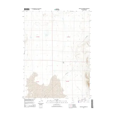
2015 Map of Double Hot Springs
USGS Topo · Published 2015About this map
Double Hot Springs and the expansive northern reaches of the Black Rock Desert dominate this part of Humboldt County. The landscape is defined by its thermal features and intermittent water sources, where the Soldier Meadow Rd provides the primary transit corridor through the arid terrain. To the north, Jackson Reservoir suggests a managed water point in an otherwise dry basin, while numerous named springs like Bronco Springs, Van Riper Spring, and Casey Springs mark critical survival and navigation landmarks for those traversing the high desert. The drainage patterns of Clapper Cr and Cow Cr underscore the region's relationship with seasonal runoff. This survey provides a precise view of the topography and hydrology in a remote corner of Nevada, emphasizing the isolation and specific geographic markers essential for regional exploration.
Find a feature on this map
14 named features on this map. Tap any name to fly to it.
Don’t see what you’re looking for? This feature index may not catch every label — zoom into the map to look around manually.
Map Details
Editions of this 2015 Double Hot Springs Map
This is the sole edition of this map. No revisions or reprints were ever made.
Other maps of this area

1886 · Disaster
USGS Topo · 1:250,000

1886 · Granite Range
USGS Topo · 1:250,000

1889 · Long Valley
USGS Topo · 1:250,000

1893 · Disaster
USGS Topo · 1:250,000

1894 · Granite Range
USGS Topo · 1:250,000

1931 · Lovelock
USGS Topo · 1:250,000

1935 · Lovelock
USGS Topo · 1:250,000

1954 · Vya
USGS Topo · 1:250,000

1955 · Lovelock
USGS Topo · 1:250,000

1958 · Vya
USGS Topo · 1:250,000