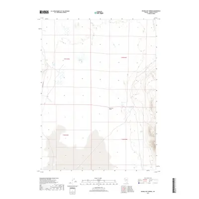
2018 Map of Double Hot Springs
USGS Topo · Published 2018About this map
Double Hot Springs and the expansive playa of the Black Rock Desert dominate this northern Nevada landscape. This modern survey illustrates a topography shaped by intermittent water sources and geothermal activity, where the desert floor meets the rising elevations of the surrounding mountains. The presence of Jackson Reservoir and named watercourses like Clapper Cr and Cow Cr indicate the critical role of moisture in this arid environment. Transport through this remote section of Humboldt County is primarily facilitated by Soldier Meadows Rd, which skirts the western edge of the desert. Along the eastern slopes, a series of natural outflows including Van Riper Spring, Bronco Springs, and Casey Springs mark historically significant points of water access for travelers and livestock in the Great Basin.
Find a feature on this map
13 named features on this map. Tap any name to fly to it.
Don’t see what you’re looking for? This feature index may not catch every label — zoom into the map to look around manually.
Map Details
Editions of this 2018 Double Hot Springs Map
This is the sole edition of this map. No revisions or reprints were ever made.
Other maps of this area

1886 · Disaster
USGS Topo · 1:250,000

1886 · Granite Range
USGS Topo · 1:250,000

1889 · Long Valley
USGS Topo · 1:250,000

1893 · Disaster
USGS Topo · 1:250,000

1894 · Granite Range
USGS Topo · 1:250,000

1931 · Lovelock
USGS Topo · 1:250,000

1935 · Lovelock
USGS Topo · 1:250,000

1954 · Vya
USGS Topo · 1:250,000

1955 · Lovelock
USGS Topo · 1:250,000

1958 · Vya
USGS Topo · 1:250,000