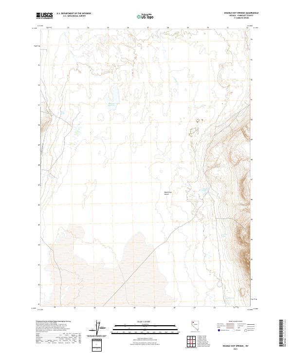
2021 Map of Double Hot Springs
USGS Topo · Published 2021About this map
Black Rock Desert dominates the lower central portion of this Humboldt County terrain, where the arid basin floor meets the rising slopes of the surrounding ranges. The area is defined by its critical water sources, most notably the geothermal waters of Double Hot Springs and more remote seeps such as Van Riper Spring and Bronco Springs. These springs have long served as vital landmarks for those traversing the high desert, providing reliable points of reference in an otherwise unforgiving environment.
Find a feature on this map
13 named features on this map. Tap any name to fly to it.
Don’t see what you’re looking for? This feature index may not catch every label — zoom into the map to look around manually.
Map Details
Editions of this 2021 Double Hot Springs Map
This is the sole edition of this map. No revisions or reprints were ever made.
Other maps of this area

1886 · Disaster
USGS Topo · 1:250,000

1886 · Granite Range
USGS Topo · 1:250,000

1889 · Long Valley
USGS Topo · 1:250,000

1893 · Disaster
USGS Topo · 1:250,000

1894 · Granite Range
USGS Topo · 1:250,000

1931 · Lovelock
USGS Topo · 1:250,000

1935 · Lovelock
USGS Topo · 1:250,000

1954 · Vya
USGS Topo · 1:250,000

1955 · Lovelock
USGS Topo · 1:250,000

1958 · Vya
USGS Topo · 1:250,000