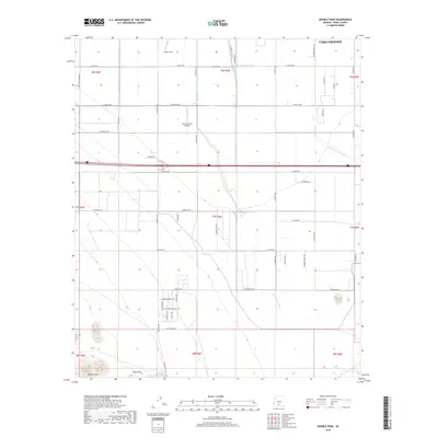
2018 Map of Double Peak
USGS Topo · Published 2018About this map
Potters Field lies in the northern reaches of this Arizona landscape, just south of the Casa Grande boundary. The region is defined by an extensive grid of agricultural and rural roads, including Murphy Rd and S Stanfield Rd, which navigate the desert terrain between ephemeral watercourses. The drainage patterns of Greene Wash and Santa Rosa Wash cut across the plains, highlighting the natural hydrology that dictates land use in the Pinal County desert.
Find a feature on this map
53 named features on this map. Tap any name to fly to it.
Don’t see what you’re looking for? This feature index may not catch every label — zoom into the map to look around manually.
Map Details
Editions of this 2018 Double Peak Map
This is the sole edition of this map. No revisions or reprints were ever made.
Other maps of this area

1922 · Casa Grande
USGS Topo · 1:62,500

1924 · Casa Grande
USGS Topo · 1:62,500

1941 · Vekol Mountains
USGS Topo · 1:62,500

1942 · Silver Reef Mountains
USGS Topo · 1:62,500

1942 · Vekol Mountains
USGS Topo · 1:62,500

1946 · Antelope Peak
USGS Topo · 1:62,500

1948 · Antelope Peak
USGS Topo · 1:62,500

1953 · Ajo
USGS Topo · 1:250,000

1956 · Tucson
USGS Topo · 1:250,000

1957 · Ajo
USGS Topo · 1:250,000