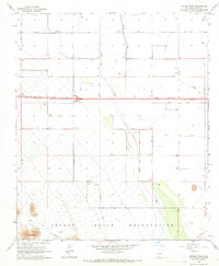
1965 Map of Double Peak
USGS Topo · Published 1966About this map
Papago Indian Reservation territory defines the southern reaches of this landscape, where the Vaiva Hills rise toward the prominent landmark of Double Peak. This mid-1960s survey captures a transition in infrastructure, most notably evidenced by a major roadway marked as Under Construction spanning the center of the sheet. The area is characterized by an extensive network of groundwater extraction, with dozens of wells scattered across the desert flats to support the region's agricultural or industrial needs.
Find a feature on this map
22 named features on this map. Tap any name to fly to it.
Don’t see what you’re looking for? This feature index may not catch every label — zoom into the map to look around manually.
Map Details
Editions of this 1965 Double Peak Map
This is the sole edition of this map. No revisions or reprints were ever made.
Other maps of this area

1922 · Casa Grande
USGS Topo · 1:62,500

1924 · Casa Grande
USGS Topo · 1:62,500

1941 · Vekol Mountains
USGS Topo · 1:62,500

1942 · Silver Reef Mountains
USGS Topo · 1:62,500

1942 · Vekol Mountains
USGS Topo · 1:62,500

1946 · Antelope Peak
USGS Topo · 1:62,500

1948 · Antelope Peak
USGS Topo · 1:62,500

1953 · Ajo
USGS Topo · 1:250,000

1956 · Tucson
USGS Topo · 1:250,000

1957 · Ajo
USGS Topo · 1:250,000