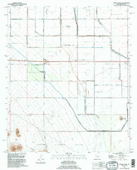
1992 Map of Double Peak
USGS Topo · Published 1995About this map
The Tohono O'odham Nation boundary marks the southern portion of this landscape, where the Vaiva Hills and the prominent summit of Double Peak rise above the basin floor. This early 1990s record captures an environment defined by extensive water management and desert agriculture, characterized by an intricate network of irrigation infrastructure. The Santa Rosa Canal and numerous segments of Road On Levee trace the path of water through the arid terrain, supporting the rectangular grid of local transport. Local transit is facilitated by a network of established thoroughfares including Stanfield Road, Greene Road, and Arica Road. Beyond the fields, the map records small-scale industrial and utility features such as a Gravel Pit and a remote Landing Strip, providing a clear view of the rural infrastructure in Pinal County during this era.
Find a feature on this map
26 named features on this map. Tap any name to fly to it.
Don’t see what you’re looking for? This feature index may not catch every label — zoom into the map to look around manually.
Map Details
Editions of this 1992 Double Peak Map
This is the sole edition of this map. No revisions or reprints were ever made.
Other maps of this area

1922 · Casa Grande
USGS Topo · 1:62,500

1924 · Casa Grande
USGS Topo · 1:62,500

1941 · Vekol Mountains
USGS Topo · 1:62,500

1942 · Silver Reef Mountains
USGS Topo · 1:62,500

1942 · Vekol Mountains
USGS Topo · 1:62,500

1946 · Antelope Peak
USGS Topo · 1:62,500

1948 · Antelope Peak
USGS Topo · 1:62,500

1953 · Ajo
USGS Topo · 1:250,000

1956 · Tucson
USGS Topo · 1:250,000

1957 · Ajo
USGS Topo · 1:250,000