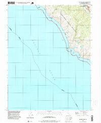
1994 Map of Double Point
USGS Topo · Published 1999About this map
Point Reyes National Seashore dominates this coastal survey, where the terrestrial landscape meets the Pacific Ocean along the dramatic Marin County shoreline. The topography reveals a series of freshwater bodies including Wildcat Lake, Pelican Lake, and Bass Lake positioned just inland from the surf. The presence of the San Andreas Rift Zone in the northeast corner provides a clear geomorphological boundary, influencing the drainage of Bear Valley Creek and the alignment of the local ridges. Hikers and historians can trace the established Coast Trail and Bear Valley Trail, which navigate the elevation changes between the high points like Firtop and the tidal reaches of Wildcat Beach. Notable coastal landmarks such as Double Point and the offshore Stormy Stack define the rugged maritime interface of the Punta De Los Soberanes land grant area.
Find a feature on this map
26 named features on this map. Tap any name to fly to it.
Don’t see what you’re looking for? This feature index may not catch every label — zoom into the map to look around manually.
Map Details
Editions of this 1994 Double Point Map
This is the sole edition of this map. No revisions or reprints were ever made.
Other maps of this area

1897 · Tamalpais
USGS Topo · 1:62,500

1914 · Petaluma
USGS Topo · 1:62,500

1916 · Point Reyes
USGS Topo · 1:48,000

1918 · Point Reyes
USGS Topo · 1:62,500

1941 · Tamalpais
USGS Topo · 1:62,500

1942 · Petaluma
USGS Topo · 1:62,500

1947 · Santa Rosa
USGS Topo · 1:250,000

1947 · San Francisco
USGS Topo · 1:250,000

1948 · San Francisco
USGS Topo · 1:250,000

1949 · Santa Rosa
USGS Topo · 1:250,000