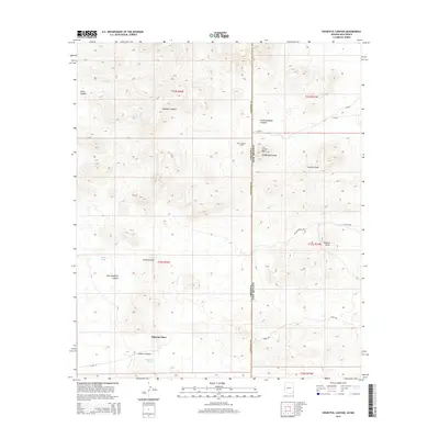
2014 Map of Doubtful Canyon
USGS Topo · Published 2014About this map
The Cochise County border with New Mexico bisects this landscape, dominated by the peaks and drainages of the Steins Peak Range. At the heart of this high-desert terrain, Steins Peak overlooks a network of canyons and draws, including Doubtful Canyon and the smaller Little Doubtful Canyon. The map records sparse but significant human indicators in a land shaped by geology, notably the Wheeler Place homestead and the solitary Giddings Grave located north of the peak.
Find a feature on this map
30 named features on this map. Tap any name to fly to it.
Don’t see what you’re looking for? This feature index may not catch every label — zoom into the map to look around manually.
Map Details
Editions of this 2014 Doubtful Canyon Map
This is the sole edition of this map. No revisions or reprints were ever made.
Other maps of this area

1917 · San Simon
USGS Topo · 1:125,000

1926 · Orange Butte
USGS Topo · 1:62,500

1928 · Chenoweth
USGS Topo · 1:62,500

1950 · San Simon
USGS Topo · 1:62,500

1950 · Vanar
USGS Topo · 1:62,500

1951 · Vanar
USGS Topo · 1:62,500

1951 · San Simon
USGS Topo · 1:62,500

1954 · Silver City
USGS Topo · 1:250,000

1958 · Silver City
USGS Topo · 1:250,000

1962 · Silver City
USGS Topo · 1:250,000