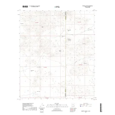
2018 Map of Doubtful Canyon
USGS Topo · Published 2018About this map
Giddings Grave marks a lonely point of historical interest along the borderlands of Arizona and New Mexico, situated near the northern edge of the Peloncillo Mountains. This desert landscape is defined by its dramatic elevation changes, where the Steins Peak Range rises sharply toward Steins Peak. The map details the complex drainage systems and canyons that carved this terrain, including the namesake Doubtful Canyon and its neighbor, Little Doubtful Canyon. Water remains a vital element of the geography, recorded here through isolated sources like Ward Spring, Canteen Spring, and man-made cattle watering points such as Dean Tank and McKenzie Tank. The network of primitive roads, including Volcano Mine Rd and Doubtful Canyon Rd, suggests a history of local mineral exploration and ranching access across the Roostercomb and through Volcano Draw.
Find a feature on this map
29 named features on this map. Tap any name to fly to it.
Don’t see what you’re looking for? This feature index may not catch every label — zoom into the map to look around manually.
Map Details
Editions of this 2018 Doubtful Canyon Map
This is the sole edition of this map. No revisions or reprints were ever made.
Other maps of this area

1917 · San Simon
USGS Topo · 1:125,000

1926 · Orange Butte
USGS Topo · 1:62,500

1928 · Chenoweth
USGS Topo · 1:62,500

1950 · San Simon
USGS Topo · 1:62,500

1950 · Vanar
USGS Topo · 1:62,500

1951 · Vanar
USGS Topo · 1:62,500

1951 · San Simon
USGS Topo · 1:62,500

1954 · Silver City
USGS Topo · 1:250,000

1958 · Silver City
USGS Topo · 1:250,000

1962 · Silver City
USGS Topo · 1:250,000