
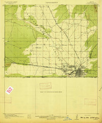
1914 Map of Douglas
USGS Topo · Published 1914About this map
Douglas serves as the industrial and urban hub of this 1913 survey, anchored by the massive Copper Queen Smelter and the Calumet and Arizona Smelter near the international boundary. The town's grid is firmly established alongside the El Paso and Southwestern railroad, which links the mining interests of the Sulphur Spring Valley to the broader regional economy. The landscape reflects a specialized frontier society where isolated schools like Valley School and Ratcliff School and named properties such as the Carey Ranch and Copper Queen Ranch dot the arid terrain north of the Arizona Sonora United States Mexico Boundary Line. Significant local infrastructure, including the County Hospital and the neighboring settlement of Pirtleville, underscores the rapid development of this copper-smelting center. The intermittent drainage of Whitewater Draw meanders through the valley, defining the topography between the industrial sites and the northern ranchlands.
Find a feature on this map
25 named features on this map. Tap any name to fly to it.
Don’t see what you’re looking for? This feature index may not catch every label — zoom into the map to look around manually.
Map Details
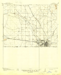
Editions of this 1914 Douglas Map
3 editions found
Other maps of this area

1902 · Bisbee
USGS Topo · 1:62,500

1910 · Bisbee
USGS Topo · 1:62,500

1916 · Pearce
USGS Topo · 1:125,000

1916 · Douglas
USGS Topo · 1:125,000

1917 · Chiricahua
USGS Topo · 1:125,000

1919 · Douglas
USGS Topo · 1:125,000

1919 · Perilla
USGS Topo · 1:125,000

1919 · Chiricahua
USGS Topo · 1:125,000

1922 · Swisshelm
USGS Topo · 1:62,500

1925 · Douglas
USGS Topo · 1:62,500