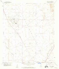
1958 Map of Douglas NE
USGS Topo · Published 1959About this map
The Sulphur Spring Valley dominates this landscape, providing a wide corridor for transportation and ranching north of the border. The Bisbee-Douglas International Airport serves as a major hub in the northwest, featuring an extensive layout of runways and facilities including fuel tanks and a water tank. A network of family-owned ranching operations like Stewart Ranch, Wells Ranch, and Harris Ranch are scattered across the valley floor, connected by unimproved roads and the prominent path of the Southern Pacific railroad line.
Find a feature on this map
22 named features on this map. Tap any name to fly to it.
Don’t see what you’re looking for? This feature index may not catch every label — zoom into the map to look around manually.
Map Details
Editions of this 1958 Douglas NE Map
2 editions found
Other maps of this area

1914 · Douglas
USGS Topo · 1:62,500

1916 · Pearce
USGS Topo · 1:125,000

1916 · Douglas
USGS Topo · 1:125,000

1917 · Chiricahua
USGS Topo · 1:125,000

1919 · Douglas
USGS Topo · 1:125,000

1919 · Perilla
USGS Topo · 1:125,000

1919 · Chiricahua
USGS Topo · 1:125,000

1922 · Swisshelm
USGS Topo · 1:62,500

1925 · Douglas
USGS Topo · 1:62,500

1926 · Pedregosa
USGS Topo · 1:62,500