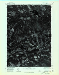
1975 Map of Dover-Foxcroft SW
USGS Topo · Published 1980About this map
Dover South Mills stands as a focal point in this mid-1970s orthophoto quadrangle, where the wooded terrain of Penobscot County meets the clearing patterns of local agriculture. Unlike traditional topographic maps, this aerial perspective reveals the precise density of forest cover and the layout of individual farmsteads around Garland and Carr Corner. The course of Black Stream is visible as it winds through the northern portion of the landscape, providing a natural drainage corridor for the surrounding timberlands. The map serves as a detailed record of land use during this era, illustrating the specific boundaries of woodlots and the network of rural roads that connected these small Maine settlements before further modern development altered the rural footprint.
Find a feature on this map
4 named features on this map. Tap any name to fly to it.
Don’t see what you’re looking for? This feature index may not catch every label — zoom into the map to look around manually.
Map Details
Editions of this 1975 Dover-Foxcroft SW Map
This is the sole edition of this map. No revisions or reprints were ever made.
Other maps of this area

1930 · Pittsfield
USGS Topo · 1:48,000

1931 · Stetson
USGS Topo · 1:48,000

1932 · Dover-Foxcroft
USGS Topo · 1:48,000

1932 · Pittsfield
USGS Topo · 1:62,500

1933 · Pittsfield
USGS Topo · 1:62,500

1933 · Guilford
USGS Topo · 1:62,500

1935 · Dover-Foxcroft
USGS Topo · 1:62,500

1935 · Stetson
USGS Topo · 1:62,500

1937 · Guilford
USGS Topo · 1:62,500

1948 · Bangor
USGS Topo · 1:250,000