2021 Map of Dover
USGS Topo · Published 2021About this map
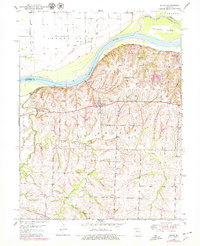
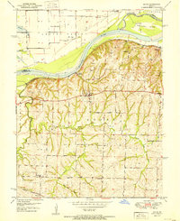
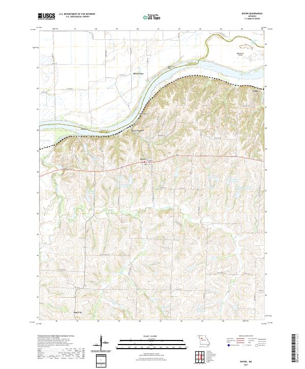
Dover and its surroundings in Lafayette County occupy a high position overlooking the Missouri River as it makes several dramatic turns, including Tabo Bend, Berun Bend, and Baltimore Bend. The settlement pattern here reflects the agricultural and topographical constraints of the river valley, with Dover Station and Miles Point situated near the water, while the interior is dotted with numerous small bodies of water and reservoirs such as Lafayette E-20 Lake and Luehrman Lake. Local roads like Berlin Rd, Schnauzer Ln, and Rocky Ford Rd cross a landscape defined by several drainages, including Cottonwood Cr and Little Tabo Cr. The presence of the Baltimore Island Chute and the prominent Dover Bluff illustrates the shifting nature of the river and the high ground that has supported these river towns for generations.
Find a feature on this map
70 named features on this map. Tap any name to fly to it.
Don’t see what you’re looking for? This feature index may not catch every label — zoom into the map to look around manually.
Map Details
Editions of this 2021 Dover Map
This is the sole edition of this map. No revisions or reprints were ever made.
Historical Maps of Dover Through Time
3 maps found