
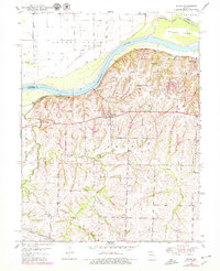
1950 Map of Dover
USGS Topo · Published 1977About this map
The Missouri River corridor in Lafayette County defines the landscape of this 1950s study, where the river's sweeping curve separates Cherry Valley from the bluffs to the south. The rural infrastructure of the era is remarkably dense, featuring a network of country schools including Dawson Sch, Willard Sch, and Hitt Sch that served the surrounding agricultural communities. The Missouri Pacific railroad tracks parallel the riverbank, connecting the riverside landing at Dover Station with the nearby settlement of Hodge.
Find a feature on this map
24 named features on this map. Tap any name to fly to it.
Don’t see what you’re looking for? This feature index may not catch every label — zoom into the map to look around manually.
Map Details
Editions of this 1950 Dover Map
2 editions found
Other maps of this area

1889 · Lexington
USGS Topo · 1:125,000

1949 · Mayview
USGS Topo · 1:24,000

1949 · Lexington East
USGS Topo · 1:24,000

1950 · Lexington East
USGS Topo · 1:24,000

1950 · Mayview
USGS Topo · 1:24,000
1951 · Dover
USGS Topo · 1:24,000

1951 · Alma
USGS Topo · 1:24,000
1951 · Higginsville
USGS Topo · 1:24,000

1951 · Waverly
USGS Topo · 1:24,000

1953 · Moberly
USGS Topo · 1:250,000