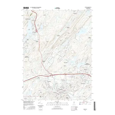
2016 Map of Dover
USGS Topo · Published 2016About this map
The Rockaway River winds through a dense industrial and residential corridor where the legacy of iron mining and transportation is still visible. In this modern survey, the dense street grids of Dover, Wharton, and Rockaway sit south of the sprawling Picatinny Arsenal complex. This area, historically central to the Morris Canal and rail networks, is marked by geographic features like Mine Hill and Randall Hill that hint at the region's mineral-rich past. To the northwest, the map transitions into the leisure-oriented landscapes around Lake Hopatcong and the Lake Shawnee development. Notable cultural landmarks include the Joe Kubert Sch of Cartoon and Graphic Art and several historic burial grounds such as Locust Hill Cem and Orchard Street Cem. The northern terrain is defined by steep ridges like Green Pond Mtn, separating narrow valleys filled with reservoirs and lakes.
Find a feature on this map
268 named features on this map. Tap any name to fly to it.
Don’t see what you’re looking for? This feature index may not catch every label — zoom into the map to look around manually.
Map Details
Editions of this 2016 Dover Map
This is the sole edition of this map. No revisions or reprints were ever made.
Other maps of this area

1888 · Franklin
USGS Topo · 1:62,500

1888 · Morristown
USGS Topo · 1:62,500

1888 · Lake Hopatcong
USGS Topo · 1:62,500

1891 · Greenwood Lake
USGS Topo · 1:62,500

1893 · Greenwood Lake
USGS Topo · 1:62,500

1894 · Morristown
USGS Topo · 1:62,500

1894 · Lake Hopatcong
USGS Topo · 1:62,500

1894 · Franklin
USGS Topo · 1:62,500

1897 · Franklin
USGS Topo · 1:62,500

1898 · Lake Hopatcong
USGS Topo · 1:62,500