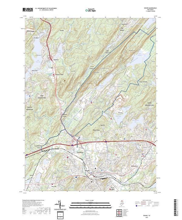
2023 Map of Dover
USGS Topo · Published 2023About this map
Dover and the surrounding industrial corridor of Morris County are defined by a landscape of valleys and ridges where iron mining and manufacturing once dominated the local economy. The terrain is marked by prominent elevations such as Picatinny Peak and Mase Mtn, while the Rockaway River and Green Pond Brook carve through the underlying geology. This area transitioned from its deep mining roots into a complex suburban and industrial network, evidenced by the proximity of the Joe Kubert School of Cartoon and Graphic Art to established residential centers like Wharton and Rockaway. Genealogy researchers will find significant value in the numerous burial grounds documented, including the Historic Cem of First Presbyterian Church and Saint Mary's Cem. The map also captures the geographic relationship between recreational water bodies like Lake Hopatcong and the more industrial pockets near Mine Hill and Mount Hope.
Find a feature on this map
83 named features on this map. Tap any name to fly to it.
Don’t see what you’re looking for? This feature index may not catch every label — zoom into the map to look around manually.
Map Details
Editions of this 2023 Dover Map
This is the sole edition of this map. No revisions or reprints were ever made.
Other maps of this area

1888 · Franklin
USGS Topo · 1:62,500

1888 · Morristown
USGS Topo · 1:62,500

1888 · Lake Hopatcong
USGS Topo · 1:62,500

1891 · Greenwood Lake
USGS Topo · 1:62,500

1893 · Greenwood Lake
USGS Topo · 1:62,500

1894 · Morristown
USGS Topo · 1:62,500

1894 · Lake Hopatcong
USGS Topo · 1:62,500

1894 · Franklin
USGS Topo · 1:62,500

1897 · Franklin
USGS Topo · 1:62,500

1898 · Lake Hopatcong
USGS Topo · 1:62,500