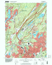
1997 Map of Dover
USGS Topo · Published 2000About this map
Green Pond Mountain dominates the landscape of northern Morris County, where the industrial legacy of iron mining intersects with mid-century suburban expansion and sprawling wildlife areas. The topography reflects a history of extraction at sites like the Mount Hope Mine and Richard Mine, which sit near the established settlements of Middletown and Wharton. To the north, the massive footprint of the Picatinny Arsenal occupies the valley beside Picatinny Lake, illustrating the significant military presence that shaped local land use through the latter half of the 20th century.
Find a feature on this map
80 named features on this map. Tap any name to fly to it.
Don’t see what you’re looking for? This feature index may not catch every label — zoom into the map to look around manually.
Map Details
Editions of this 1997 Dover Map
This is the sole edition of this map. No revisions or reprints were ever made.
Other maps of this area

1888 · Franklin
USGS Topo · 1:62,500

1888 · Morristown
USGS Topo · 1:62,500

1888 · Lake Hopatcong
USGS Topo · 1:62,500

1891 · Greenwood Lake
USGS Topo · 1:62,500

1893 · Greenwood Lake
USGS Topo · 1:62,500

1894 · Morristown
USGS Topo · 1:62,500

1894 · Lake Hopatcong
USGS Topo · 1:62,500

1894 · Franklin
USGS Topo · 1:62,500

1897 · Franklin
USGS Topo · 1:62,500

1898 · Lake Hopatcong
USGS Topo · 1:62,500