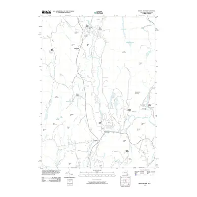
2010 Map of Dover Plains
USGS Topo · Published 2010About this map
Dover Plains and its neighboring hamlets sit along the north-south corridor of the Tenmile River and Swamp River, forming a distinctive settlement pattern through the valley. The landscape is defined by the high ridges of Chestnut Ridge and Schaghticoke Mountain that flank the river valley, where agricultural and industrial remnants like Dover Furnace remain as markers of the area's development. Local landmarks such as the natural formation known as The Stone Church and the Bulls Bridge Covered Bridge across the Housatonic River anchor the cultural geography of the New York and Connecticut border. Smaller communities like Oniontown, Wingdale, and Webatuck are interspersed with family-named locations such as Bains Corner and Dogtail Corners, while recreational spaces like Camp Siwanoy and the Wiley Shelter occupy the more secluded elevations.
Find a feature on this map
97 named features on this map. Tap any name to fly to it.
Don’t see what you’re looking for? This feature index may not catch every label — zoom into the map to look around manually.
Map Details
Editions of this 2010 Dover Plains Map
This is the sole edition of this map. No revisions or reprints were ever made.
Other maps of this area

1892 · Cornwall
USGS Topo · 1:62,500

1892 · New Milford
USGS Topo · 1:62,500

1893 · New Milford
USGS Topo · 1:62,500

1893 · Cornwall
USGS Topo · 1:62,500

1893 · Clove
USGS Topo · 1:62,500

1894 · Clove
USGS Topo · 1:62,500

1898 · Clove
USGS Topo · 1:62,500

1899 · Millbrook
USGS Topo · 1:62,500

1901 · Clove
USGS Topo · 1:62,500

1902 · Millbrook
USGS Topo · 1:62,500