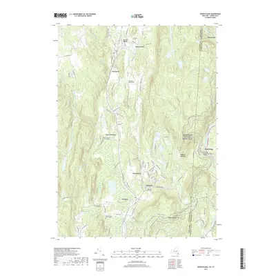
2019 Map of Dover Plains
USGS Topo · Published 2019About this map
Dover Plains and the surrounding valley of the Tenmile River define this stretch of the New York-Connecticut borderlands. The landscape is marked by a legacy of early industry and family settlement, from the site of Dover Furnace to specialized infrastructure like the Lime Kiln Road Bridge. Genealogists will find significant value in the detailed mapping of ancestral resting places, including the Hoag Family Burial Ground, Sheldon Family Burial Ground, and the South Dover Rural Cemetery. The eastern portion of the map is dominated by the corridor of the Appalachian National Scenic Trail, which winds through the elevations near Wiley Shelter and crosses into Connecticut toward Bulls Bridge. Small hamlets such as Wingdale, Webatuck, and Oniontown are shown alongside the natural features of Tamarack Swamp and Bear Swamp, illustrating the persistent settlement patterns of Dutchess County.
Find a feature on this map
120 named features on this map. Tap any name to fly to it.
Don’t see what you’re looking for? This feature index may not catch every label — zoom into the map to look around manually.
Map Details
Editions of this 2019 Dover Plains Map
This is the sole edition of this map. No revisions or reprints were ever made.
Other maps of this area

1892 · Cornwall
USGS Topo · 1:62,500

1892 · New Milford
USGS Topo · 1:62,500

1893 · New Milford
USGS Topo · 1:62,500

1893 · Cornwall
USGS Topo · 1:62,500

1893 · Clove
USGS Topo · 1:62,500

1894 · Clove
USGS Topo · 1:62,500

1898 · Clove
USGS Topo · 1:62,500

1899 · Millbrook
USGS Topo · 1:62,500

1901 · Clove
USGS Topo · 1:62,500

1902 · Millbrook
USGS Topo · 1:62,500