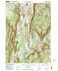
1998 Map of Dover Plains
USGS Topo · Published 2001About this map
The Tenmile River valley serves as the central corridor for this late-century landscape, where the Metro North rail line connects small settlements like Dover Plains and Wingdale. The terrain is defined by steep ridges, notably Chestnut Ridge to the west and the heights of Schaghticoke Mtn to the east, which straddles the border near the Schaghticoke Indian Reservation.
Find a feature on this map
53 named features on this map. Tap any name to fly to it.
Don’t see what you’re looking for? This feature index may not catch every label — zoom into the map to look around manually.
Map Details
Editions of this 1998 Dover Plains Map
This is the sole edition of this map. No revisions or reprints were ever made.
Other maps of this area

1892 · Cornwall
USGS Topo · 1:62,500

1892 · New Milford
USGS Topo · 1:62,500

1893 · New Milford
USGS Topo · 1:62,500

1893 · Cornwall
USGS Topo · 1:62,500

1893 · Clove
USGS Topo · 1:62,500

1894 · Clove
USGS Topo · 1:62,500

1898 · Clove
USGS Topo · 1:62,500

1899 · Millbrook
USGS Topo · 1:62,500

1901 · Clove
USGS Topo · 1:62,500

1902 · Millbrook
USGS Topo · 1:62,500